October 18, 2007
Improved forecasting of volcanic eruptions is part of Malone’s legacy
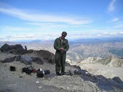
When Steve Malone retired earlier this month, he could take satisfaction in the great strides that have been made in forecasting volcanic eruptions, particularly in the Pacific Northwest. He was in the vanguard helping to develop those forecasting methods when Mount St. Helens became a global icon in 1980.
“The techniques developed at St. Helens were used to great success at Pinatubo in the Philippines 10 years later,” he recalled. “And, of course, those techniques are now used worldwide, each with its local modifications.”
More than 150 people gathered in Kane Hall on Sept. 28 to celebrate the career of the scientist who was among the first to recognize, all those years ago, that the increased seismic activity at Mount St. Helens meant that the Cascades volcano was rumbling to life.
Malone, who will continue working at a much-reduced level, came to the UW geophysics program in 1972 as a postdoctoral researcher, fresh from completing his studies at the University of Nevada, Reno. He grew up in Auburn, Ala., where his father taught comparative literature, but he came West for undergraduate work in physics at Occidental College in the Los Angeles area.
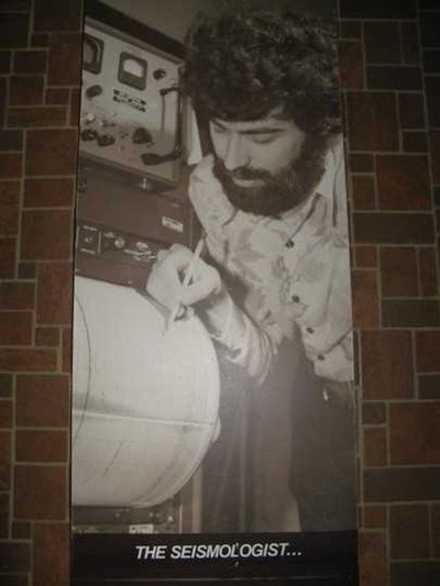
By 1975 he was operating a seismograph network in Eastern Washington to complement one in Western Washington run by UW geophysics colleague Robert Crosson. The networks operated separately until early 1980, when the U.S. Geological Survey donated computers that allowed for a unified network that Malone and Crosson directed.
That network has grown into the highly successful Pacific Northwest Seismic Network, which Malone has overseen for the last 15 years. As part of that work, for the last decade he also has been a key player in developing the Advanced National Seismic System, which uses modern monitoring and technology to provide accurate and timely information about seismic events, including their effects on buildings and structures.
But the Northwest’s first advanced system, made possible by donated computers, began operating on March 1, 1980 — just three weeks before the first earthquake marked the end of St. Helens’ dormancy.
“That was quite an adrenalin-filled period,” Malone recalled. “We were working very hard here in the lab to monitor the volcano, starting with the first earthquake, and we were hopeful we would detect any change in activity.”
Before long, the northern flank of the mountain began to bulge and scientists placed a sensor there hoping to spot signals that an eruption was looming. Instead, without warning, an earthquake caused a huge landslide on May 18 that triggered the eruption, which killed 57 people, including U.S. Geological Survey scientist David Johnston, who had earned his doctorate at the UW two years earlier.
“Not only had we missed it, but a friend and colleague had been killed, along with a lot of other people,” Malone said.
The signals Malone expected to see with the first eruption simply never materialized, and the eruption itself exceeded scientists’ expectations. “But our development of skills allowing us to predict later eruptions at Mount St. Helens was pretty heartening,” he said.
The groundwork had been laid for a monitoring system that has helped scientists keep close tabs on St. Helens and other volcanoes. Today the improved technology allows real-time detection and monitoring from a series of instruments that beam data directly from St. Helens to the UW seismology laboratory, and GPS sensors make it far easier to detect deformation associated with volcanoes. In fact, technology allows scientists to observe a volcano from anywhere in the world using the Internet.
When St. Helens reactivated in 2004, scientists developed a much narrower range of expectations based on their previous experiences and were on target with their forecasts.
Malone says simply, “We nailed it.”
Tag(s): College of the Environment • Department of Earth and Space Sciences • earthquakes & seismology • Steve Malone
