November 15, 2007
Scientists coaxing world’s oceans to reveal subsurface secrets
The only global-ocean climate-monitoring system — comprised of satellites and specialized floats — passed a milestone earlier this month when a UW and Scripps Institution of Oceanography expedition was in a position to deploy Argo float No. 3,000.
“Argo, in conjunction with satellites, is the best global-scale observation system we’ve ever had and probably will be for at least the next decade,” says Stephen Riser, UW professor of oceanography. He was among the earliest organizers of the program to deploy 3,000 floats in the deep waters of the world’s oceans.
Since the project’s launch in 2000, Riser’s UW team has received $24 million in funding and has been responsible for building and deploying nearly 20 percent of all the Argo floats. Only U.S. partner Scripps and the country of Japan have deployed as many.
Argo floats measure temperature and salinity — often called the vital signs of the ocean. Those measurements in recent years have been used around the world to improve seasonal climate forecasts and refine climate models. Some countries in the 22-nation Argo network — including Ecuador and Kenya, two of the newest members — want the ocean data for their fisheries management models, Riser says. The measurements also will help scientists and policy makers understand how the oceans have absorbed most of the excess heat from global warming during the past 50 years.
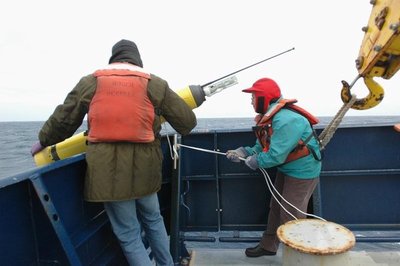
In seven years of launching Argo floats, the UW team is the only group to successfully drop floats from airplanes and was the group that first demonstrated innovative ways to deploy Argo floats from commercial vessels — container ships traversing the world’s oceans at full speed and not willing to stop and gently lower floats over the side.
The key is having just the right packaging, usually made of cardboard, that can protect a float’s antenna on impact but that can be easily shed once the float is submerged. At one point early on, the UW team was wrapping floats in cardboard held in place with string and candy Lifesavers — yes, Lifesavers — that would dissolve once in the salt water, freeing the float.
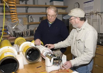
UW’s major contribution apart from the deployment efforts, Riser says, has been improving commercially available parts and floats to increase their capabilities.
“Early on, neither the batteries nor the internal mechanical parts were good enough,” Riser says. “Because we were buying the parts and building our own floats we learned a lot and helped on the ground floor to get the float technology so it was working and reliable.”
It’s something both commercial manufacturers and other Argo partners have readily taken advantage of, which is just fine with the UW team.
Riser says research scientist and engineer Dana Swift is the brains behind the UW’s Argo float production efforts, most recently leading efforts to re-engineer the floats for the waters around Antarctica. Those floats shouldn’t try to surface during the six months each year that part of the ocean is under ice.
As part of the International Polar Year now being celebrated, 100 floats specially built by the UW were deployed in Antarctic waters in September.
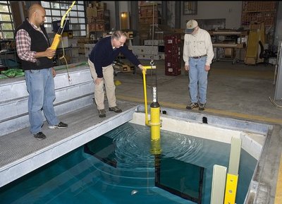
Most of the Argo floats around the world don’t take a six-month hiatus from transmitting data. Instead, they hang out about 1.25 miles beneath the ocean surface and begin to surface once every 10 days while measuring temperature and salinity. At the surface the floats start trying to transmit that data. If there is a satellite overhead, the data can be available on the Web within 24 hours for all to use.
Attaining the goal of 3,000 Argo floats means there’s a float covering roughly every 200 square miles of the Earth’s deep oceans. Consider the Pacific Ocean between Seattle and Japan, Riser says. Before Argo there would be maybe one or two points of data gathered each year across that 4,900-mile expanse of ocean. Now there are as many as 900 points every 10 days.
Argo floats worldwide are making 100,000 profiles a year, 20 times more than possible using ships. A profile is the data collected concerning water properties each time the float surfaces.
To ensure the floats are working correctly, UW’s Annie Wong, a research scientist and engineer in oceanography, developed a set of tools to assess what is being transmitted. All 22 countries involved in the Argo program have adopted Wong’s methodology and programs.
The challenge now that 3,000 floats are in the water is to continue replacing the ones that have reached the end of their useful lives, something that happens after about 4 ½ years, Riser says.
The National Oceanic and Atmospheric Administration is very supportive of the replacement effort, Riser says. The $24 million the UW has received for Argo includes $16.5 million awarded by NOAA just last summer to schedule expeditions and replace floats through 2011. In the meantime officials are considering whether the Argo program should one day be run like the National Weather Service.
Tag(s): Argo floats • School of Oceanography • Stephen Riser


