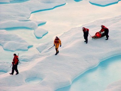
Loss of sea ice that is more than a year old – called perennial ice – may be the key predictor for how much Arctic ice melts each summer, a University of Washington polar scientist says. He says the loss of perennial ice in the last two years led to this summer’s record-breaking ice retreat.
A paper being published online today by Geophysical Research Letters, says perennial sea ice covering the Arctic Ocean decreased by 23 percent during the past two winters as strong winds swept more Arctic ice than usual out Fram Strait near Greenland. The study relied on 50 years of data from the International Arctic Buoy Program, currently directed by Ignatius Rigor of the UW’s Applied Physics Laboratory, and eight years of data from NASA’s QuikScat satellite, a review of which was led by Son Nghiem of NASA’s Jet Propulsion Laboratory.
“The most important thing about this paper is that it foretells this summer’s record minimum ice extent in the Arctic,” Rigor, a research scientist and co-author on the paper, says. “While the total area of ice cover in recent winters has remained about the same, during the past two years an increased amount of older, thicker perennial sea ice was swept by winds out of the Arctic Ocean into the Greenland Sea. What grew in its place in the winters between 2005 and 2007 was a thin veneer of first-year sea ice, which simply has less mass to survive the summer melt.”
- Find pdf of paper on the right.
- NASA’s release also on the right.
Thin veneer
Single-year ice is typically less than 5 feet thick; 2- to 3-year-old ice averages 6 ½ feet thick; and ice 10 years or older averages more than 16 feet thick, Rigor says. The ice cover typically loses 5 feet of thickness during the summer melt season, April through September.
Data from the newly published paper are from measurements made each March, just before the start of the melt season. The figures have been converted from square kilometers to square miles.
| Perennial | Single-year | Mixed ice types | Total sq. miles | |
| 2005 | 1.83 million sq. miles | 2.45 million | 1.16 million | 5.56 million |
| 2006 | 1.65 million sq. miles | 2.55 million | 1.17 million | 5.56 million |
| 2007 | 1.41 million sq. miles | 2.74 million | 1.26 million | 5.56 million |
While the total area of ice cover has remained about the same, the amount of ice more than a year old has declined by 420,000 square miles, a 23 percent reduction.
Discerning ice of different ages
Information from the International Arctic Buoy Program and NASA’s QuikScat satellite serve to corroborate each other in the eight years since QuikScat started operating. Both are able to discern single-year ice from multi-year ice, something other satellites can’t do. QuikScat, however, can only say if ice is younger than a year or older than a year, whereas the buoys provide data to estimate the age of sea ice.
The International Arctic Buoy Program originated at the UW’s Applied Physics Laboratory in 1979 and involves efforts by many nations to get the best possible coverage of the Arctic. In addition to Rigor serving as director of the program, he and other scientists at the Applied Physics Laboratory have been responsible for buying or deploying half of all the buoys in the current program. Because this is International Polar Year, there was extra funding for the buoy program which more than quadrupled the number of buoys to nearly 200 this year.
Steely perennial ice
- The average age of perennial ice was more than 10 years prior to 1989. More recently the average age is 3 years.
- There have been instances in which ice has been known to survive 30 years or more. An ice station known as T-3, for instance, was abandoned in 1954 but the remains continued to be sighted for 30 years.
- Perennial ice averages 6 ½ to 16 ½ feet in thickness.
- Powerful winds and ocean circulation can force places where the ice is even thicker because of ridging and rafting. The ridges can tower over the surface of the ice, while below, keels of ice as long as 40 feet can jut into the ocean.
- The coastline of Canada’s arctic archipelago near Greenland is an area with so much of this ridging and rafting that icebreakers take care to skirt the area.
Older ice swept out of Arctic
The same wind and ocean circulation that shoves ice in thick layers against Canada’s arctic archipelago also propels ice just as forcefully out Fram Strait along Greenland’s eastern shore. The ice eventually melts in the Atlantic Ocean. Winds the last two years, powered by the Arctic Oscillation, were particularly strong and swept out more ice than usual, something that also happened in the early 1990s.
See release at http://uwnews.org/article.asp?articleID=7070.
Additional background papers
- “Variations in the age of sea ice and summer sea ice extent,” 2004, http://seaice.apl.washington.edu/IceAge&Extent/Rigor&Wallace2004.pdf
- “On the response of sea ice to the Arctic Oscillation,” 2002, http://seaice.apl.washington.edu/Papers/RigorEtal2002.pdf
- “The thinning of arctic sea ice, 1988-2003: Have we passed a tipping point?” 2005, http://psc.apl.washington.edu/lindsay/pdf_files/Lindsay_Zhang_tipping_point.pdf
Rigor’s work is funded by the Office of Naval Research, NASA, National Ice Center, National Science Foundation and the National Oceanic and Atmospheric Administration.
###
For more information: Rigor, (206) 685-2571, ignatius@apl.washington.edu