Senior Jennifer Glass was back in class Monday after returning from Ecuador where she had a chance to lead a group making the first detailed maps of a seafloor rift that’s part of the hot spot responsible for the formation of the Galapagos Islands. Because she’s the first to map it so thoroughly, and it didn’t have an official name, she got the honor of naming the rift, enlisting the help of elementary school students to do so.
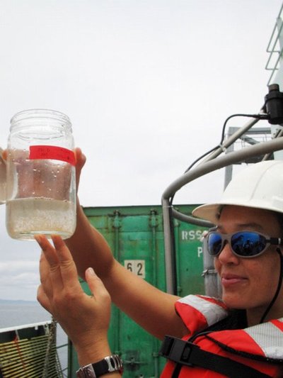
Glass is one of 9 undergraduates, each with a different research project, who just got back from the Galapagos Islands off Ecuador. Eleven other of her classmates in the School of Oceanography’s senior thesis class are in that region this week taking turns conducting research on board the UW’s 274-foot oceanography vessel the Thomas G. Thompson.
It’s a unique opportunity, says Rick Keil, associate director of oceanography who is helping with the expedition remotely, from back here in Seattle. The UW is the only U.S. university that uses a ship as large and sophisticated as the Thompson — one of a class of vessels know as Agor-9 — for student education, he says.
The expedition, which can be followed at http://courses.washington.edu/ocean444/index.html, ends Jan. 29.
The Galapagos Islands are known as the place where Charles Darwin did his studies on evolution. The ocean around the island chain holds interests for scientists too. The upwelling of nutrients there, for example, make for a rich ocean food web, it was the first place scientists actually saw hydrothermal vents and, because the region responds strongly to climate change, scientists are interested in how marine species are reacting.
The seafloor there is one of only a hundred hot spots around the world that are far from plate boundaries but where magma still manages to burn holes through the Earth’s crust, resulting in the formation of volcanic islands.
The rift off the corner of Fernandia Island “is believed to be located right above the most active part of the Galapagos Hot Spot, the thermal anomaly in the Earth’s mantle and crust that creates this volcanic island chain,” Glass wrote in her ship blog. “My goal is to generate a high-resolution map of this ridge and identify volcanic features that signal to me what stage of development the rift zone is currently undergoing.”
Up at 4 a.m. the day she was to conduct her project, she wrote in her blog, “By 7:30 a.m. we were under way on the tracks I had laid out to follow. In many ways, mapping the seafloor with the EM300 multibeam sonar is like mowing the lawn. As the ship moves over the seafloor, a swath of sonar is beamed out below it and collects bathymetry data. Just like mowing the lawn, it’s essential to make sure the swaths overlap as the ship returns on the next line. The captain and crew did an excellent job keeping the ship on target following the lines I’d laid out.”
The resulting maps have 20 times higher resolution than those from 10 years ago and two times higher resolution of those five years ago.
“Jennifer was able to make some fundamental discoveries of new features, such as the volcanic pits and slumps she describes in her blog,” says Keil. “The resolution of the map she created has already allowed her and an Ecuadorian geologist she is collaborating with to describe new features about the ridge that have never been observed before.”
Talking Monday on her cell as she commuted by bus to campus, Glass said she really learned the importance of collaboration during the expedition, having chances to work with faculty from the UW and Woods Hole Oceanographic Institution, an Ecuadorian navy lieutenant with a master’s in geophysical mapping and the ship’s marine technicians.
The contest she conducted to name the rift was open to elementary school students who have been following the expedition on the Web. The winning entry from was “Juana Ridge,” which comes from Mad Joan, the only heiress of Ferdinand and Isabella, after whom the Galapagos islands of Fernandina and Isabella are named.
Glass’ blog from Jan. 17 is at
http://courses.washington.edu/ocean444/galapablog/blogs1/indexJan17J.html
Fourteen Ecuadorian scientists are part of the expedition. This is the first time Ecuadorian scientists have allowed a research ship to extensively map so close to shore, with the Thompson getting as close to shore as possible at times, Keil says.
Professor Roy Carpenter, Research Professor Mark Holmes, Assistant Professor Gabrielle Rocap and professor Seelye Martin, all with the School of Oceanography, are on the ship helping the students who are working on projects ranging from geophysics to biology to ocean dynamics. This is the kind of educational experience only major research institutions such as the UW can offer undergraduates as a capstone experience.
The experience differs from most oceanographic expeditions because the faculty are there to help the students with their projects, not the other way around.
In their blogs, the students aren’t just writing about their research, of course. They’re also writing about their experiences traveling overseas.
The “Things we have learned during our stay in Ecuador and the Galapagos Islands” blog, dated Jan. 17–19, includes tips from Jaqui Neibauer, Allison Cougan, AJ Lefevre, Joni Wederman and Kati Geri such as:
“Don’t touch the turtles and don’t stand on their feeding platform. You will get yelled at! Plus, do you think they like the idea of you standing on their dinner table?”
“Beware of the Iguanas! They may seem timid enough, but they will show their feisty side if necessary. This goes for the wild dogs, too!”
And, “Swim suits and flip flops are not appropriate attire to wear when trekking through lava beds. We were able to go ashore at one of our snorkeling stops, but didn’t know that before leaving our hotel. We had a flip-flop blow-out and many sunburned oceanographers by the time the day was over.”